
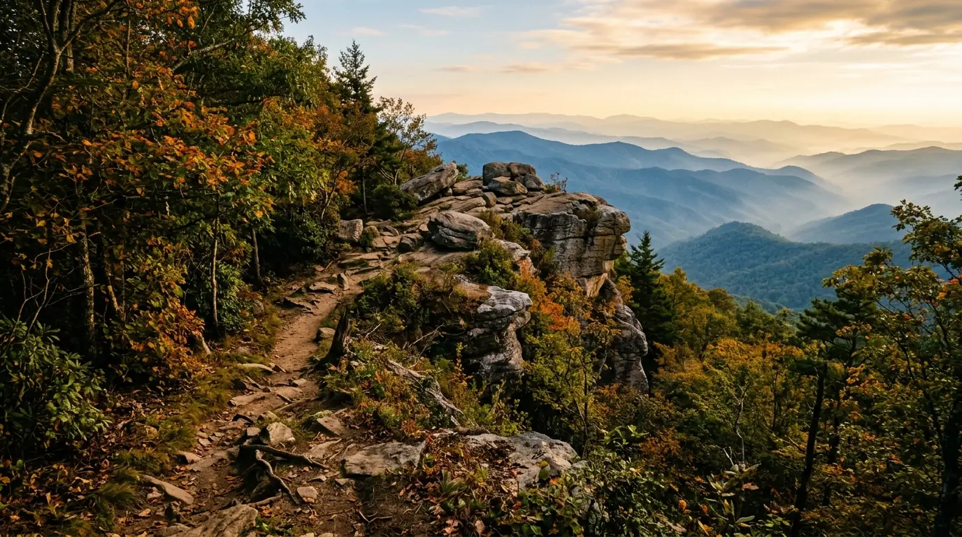
Blood Mountain is the highest peak on the Appalachian Trail in Georgia, standing at 4,458 feet above sea level within the Chattahoochee National Forest. Located roughly twelve miles from Dahlonega, it offers popular hiking routes like the 2.2-mile trail from Neels Gap, scenic Blue Ridge views, and the historic stone Civilian Conservation Corps shelter at its summit.
At 4,458 feet above sea level, Blood Mountain stands as the highest peak on the Appalachian Trail in Georgia and one of the most storied summits in the entire 2,190-mile footpath.
Mountain History and Geology
Located within the Chattahoochee National Forest approximately twelve miles southeast of Dahlonega, Blood Mountain draws tens of thousands of hikers annually—from casual day-trippers seeking panoramic views to thru-hikers marking their first major milestone on the journey to Maine.
Blood Mountain’s vivid name has inspired considerable speculation over the years. The most widely repeated origin story holds that a brutal battle between the Cherokee and the Creek nations was fought on or near its slopes, staining the mountain’s rocks red with the blood of fallen warriors. Historical and archaeological evidence for a specific decisive engagement at this site is limited. A more prosaic explanation ties the name to red lichens, such as Cladonia cristatella , that coat the summit rocks and give them a reddish cast when wet. The Cherokee called the mountain Slaughter Mountain in some accounts.
The mountain falls within the Blood Mountain Wilderness, a federally designated wilderness area of approximately 7,800 acres established in 1991. Wilderness designation prohibits mechanized equipment, motorized vehicles, and commercial activities within the area’s boundaries. Geologically, the summit is capped by Blood Mountain Biotite Gneiss formed roughly one billion years ago during the Grenville orogeny. Subsequent tectonic events over hundreds of millions of years shaped the crystalline gneisses and schists visible today. The open rocky summit supports a Southern Appalachian Rocky Summit ecosystem, a globally rare plant community.
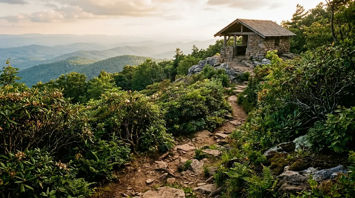
Built by the Civilian Conservation Corps in the 1930s, the stone Blood Mountain Shelter accommodates eight to twelve hikers in its sleeping loft and features a rare stone fireplace.
Primary Routes to the Summit
Hikers reaching the summit can choose from multiple established trail approaches depending on their experience level and preferred distance.
| Route Name | Distance | Elevation Gain | Key Highlights |
|---|---|---|---|
| Appalachian Trail from Neels Gap | 2.2 miles one way | 1,340 feet | Passes through Mountain Crossings outfitter building |
| Freeman Trail Loop via Slaughter Creek | 6 miles loop | 1,700 feet | Varied forest types and a less crowded trail experience |
The most heavily traveled approach begins at Neels Gap (elevation 3,125 feet) on U.S. Highway 19/129, where the Appalachian Trail passes directly through the Mountain Crossings outfitter and hostel. From the gap, the trail gains approximately 1,300 feet over 2.2 miles to the summit, making a 4.4-mile round trip. Parking fees or trail use requirements should be confirmed with local authorities prior to visiting.
Views, Seasonal Tips, and Nearby Trails
On clear days, the summit offers views across the Blue Ridge toward the Smokies to the north and west, while the Georgia piedmont stretches to the south and east. During late May and early June, mountain laurel and Catawba rhododendron bloom near the summit. Visitors interested in fall color in the North Georgia mountains will find October ideal for crisp hiking conditions and vibrant foliage.
Starting early—on the trail by 7 a.m. during summer—helps avoid peak heat, high humidity, and mid-morning parking crowds at Neels Gap.
Ice and snow can make the upper rocky sections below the summit hazardous; micro-crampons are strongly recommended when temperatures drop below freezing.
Those interested in living in Dahlonega enjoy close access to additional outdoor options and the local food scene . Other nearby recreational sites include:
- Amicalola Falls State Park Approach Trail: Located fifteen miles west of Dahlonega, featuring a 729-foot cascading waterfall and connections to Springer Mountain.
- Yahoola Creek Reservoir Trail: A gentle 3.5-mile loop trail around the shoreline just north of town.
- Chestatee River Greenway: Offers Class I and Class II whitewater for canoeing, kayaking, and tubing.
To discover more outdoor options, explore additional local activities and town attractions .
Frequently Asked Questions
Where is Blood Mountain located?
Blood Mountain is located within the Chattahoochee National Forest, approximately twelve miles southeast of Dahlonega along the Lumpkin and Union County line.
How long is the hike to the summit from Neels Gap?
The hike from Neels Gap to the summit is 2.2 miles one way (4.4 miles roundtrip) with an elevation gain of approximately 1,400 feet.
Can hikers stay overnight at the summit shelter?
The historic stone Blood Mountain Shelter operates on a first-come, first-served basis for overnight users. Camping within the Blood Mountain Wilderness is restricted to designated sites, and dispersed camping is prohibited within a quarter-mile of the trail.
Explore North Georgia Living
Find your ideal mountain retreat or home near the trails with Gold Peach Realty.
Search North Georgia homes with Gold Peach Realtyor call (770) 283-1223